Devereux & Associates L.L.C.
Practical Solutions in
Spatial Data Technologies

[ Services ] [Home]

Air Photo/ Remote Sensing


Home
Up

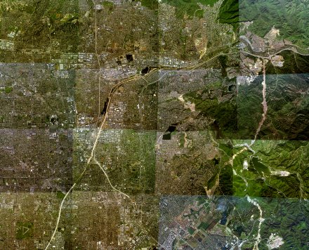
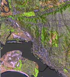
Digital imagery is a key element of most GIS programs.  Devereux and Associates can coordinate the acquisition of new aerial photography or convert your existing aerial photos to digital format that are GIS ready.  We can also handle the complicated tasks of locating, acquiring and analyzing aerial and  remotely sensed data. 


Services:

bulletDigital Imagery
    OrthoRectification
    GeoReferencing
    Seemless Mosaicing
    Image Scanning
bulletCustom Projections
bulletDigital Conversion of Existing Air Photo Hardcopies
bulletTopographic and Planimetric Feature Extraction
bulletAnalysis and Classification of Remotely Sensed Data
bulletLand Use/Land Cover Classifications
bulletChange Analysis


Information Request Form

Select the items that apply, and then let us know how to contact you.

Send service literature
Send company literature
Have a salesperson contact me

Name
Title
Company
Address\\\
E-mail
Phone